Hi folks,
I'm interested in hearing about what, if any, open source GIS tools are being used by members of the WNC GIS group. It was clear at the NCGIS conference in March that there is a vibrant open source GIS community in the state -- is the same true for our group? If you are using open source tools, please post a reply comment to this posting and let us know what you are using and why.
Neil may think this is a blatant 11th hour attempt to boost my chances for today's book drawing (and okay, so maybe it is), but I really would like to know more about any open source efforts out there....
Thursday, April 26, 2007
Wednesday, April 25, 2007
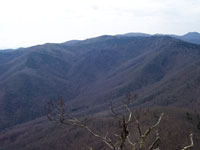
UNCA Campus Mapping Project

Hi, I'm Josh O'Conner a student of UNCA/NEMAC and Haywood Community College. I just wanted to make a quick post about the Campus Mapping Project at UNCA being conducted by the UNCA Transportation Department and NEMAC.


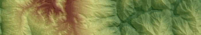
The map was created using existing data available in CAD formats and then digitizing missing information from the 2002 orthographic photos. Due to the evolution of the campus from 2002 to present additional orthos were integrated by georeferencing some of the Google Earth imagery. The framework of the map is very near completion and ideally we will be able to offer the map to UNCA faculty and staff through the ArcReader software. The ArcReader application will include certain attribute information useful to the campus staff. Other plans for the map include web applications for visitors and a possible overlay for Google Earth.
Tuesday, April 10, 2007
WNCGIS Map Trivia Contest Rules!
If you read the Blog regularly, or if you contribute to the Blog, you have a pretty darn good chance of becoming one of the monthly “Wieners.”
Here is the way this near-random drawing/competition works.
1) A “Did you know?” Map Trivia question is presented on the Blog early in the month.
2) You should
a. Check the Map Trivia question on the Blog
b. Assess the question,
c. Review the reference info if you have time and
d. Submit your guess or answer to wncgis@gmail.com.
Trivia Contest Entries
1) If your answer to the question IS CLOSE, your name is entered into the drawing (single entry). “IS CLOSE” is defined as anyone who submits any answer. This ain’t rocket science.
2) If your answer is “EXACT” (the same answer as we have) you get two entries into the drawing. Sometimes there may not be an exact answer so if you are hovering around the same answer we have, that answer is EXACT, This is the judge’s call. This ain’t rocket science.
Blog entries.
3) If you also contribute a MEANINGFUL blog entry, you receive an additional entry in the drawing for each posting
4) To qualify you have to be on the email list. Those people on the review team are excluded.
Only first guesses count.
If you submit several guesses, only the first guess will count. You have to use the email address that we have on the mailing list.
At the end of the month at the WNCGIS gathering someone in the crowd will select a “wiener.”
So at this moment David Abernathy is in the lead with his single Blog posting. Actually he will have to make a guess at the Map Trivia Question before he becomes a contestant.
The Map Trivia Contest Prize: a book from Malaprops Bookstore
If Abernathy wins this month he will get a copy of the book, The Ghost Map by Steven Johnson ($26.95 value). This book is donated by Malaprops Bookstore. These folks are great! I like Abernathy a lot, but I would hate for him to win the prize from just one blog entry.
Statistical chances are pretty good.
At this point Abernathy has a great chance of winning the first book. He has no competition. However, there are over 60 people on the email list. Abernathy’s worst nightmare is that everyone on the list submits an answer and a blog entry. But the reality is that for this first month, the chances may be more like 1:10 or 1:25.
Contest Entries
Send your answers to The Map Trivia question to wncgis@gmail.com. I will collect your responses to the Map Trivia Contest question. And remember
If you are close you get 1 entry.
If you are exact, you get 2 entries.
If you post a Blog entry we will pull your name from the Blog.
If you show up at the WNCGIS Meeting Thursday, April 26th, then you get one additional entry.
Thursday, April 5, 2007
GoogleMaps implements MyMaps
The social computing and GIS revolution continue to racing foward today with Google releasing a new 'My Maps' tab on Google Maps. This new feature allows users to easily create and share geo-specific content using their mapping API. Over the past 2 years, thousands of mash-ups have been created using Google Maps and now it has become even easier. There are tools for creating point, line and polygons on your map as well as saving to a URL, KML, emailing and printing. Of course your maps can be made public or private. Go give it a try!
http://maps.google.com
http://maps.google.com
Subscribe to:
Posts (Atom)